DUE TO SPAM, SIGN-UP IS DISABLED. Goto Selfserve wiki signup and request an account.

...
|
|---|
...
Anchor milestone1 milestone1
...
- Research existing Map Visualizations, and propose a suitable one that respects the license limitations of Apache Zeppelin
- Make a JIRA issue and start a conversation in the mailing list
- Implement the new visualization as much as possible outside of the paragaph.js file (new file)
- Add the testing system to our Grunt process
- Make tests for the new Map visualization
- Make 2-3 scenario tests for Zeppelin
...
Data validation is exposed as services. (you can set schema for data model and called with the services)
| Anchor | ||||
|---|---|---|---|---|
|
Milestone-7
Description
In this milestone, we will work on Zeppelin Code Base. Improve Data Validation factory for generalize mode and where it can be extendable.
Feature List
- Build Data validation method for other charts in zeppelin (Basic Validation)
- eg: Bar chart, Line chart, Bubble chart.. etc. (string and number validation)
- Adding Type validation for Map and charts in zeppelin.
- Adding Map Data Validated for latitude and longitude (data range validation)
Resources
|
|---|
Task List
- Data Validation factory for generalize mode
- Adding Basic type validation feature for `DataValidator` factory
- Exposing data validation as services in `DataValidatorService`
- Schema are configured in data-validator-schema.js
...
- Adding Type validation for Map and charts in zeppelin.
- chart-data-validator-factory for validate d3 basic chart data model
- map-data-validator-factory for map data model
- scatter-data-validator-factory for scatter and bubble chart data model
- Adding Map Data Validated for latitude and longitude (data range validation)Paragraph controller will using data validation before chart drawing (since error services is not in zeppelin it is using console.log at the moment)
longitudeValidator : .Longitude measurements range from 0° to (+/–)180°
latitudeValidator : Latitude measurements range from 0° to (+/–)90°.
...
Results
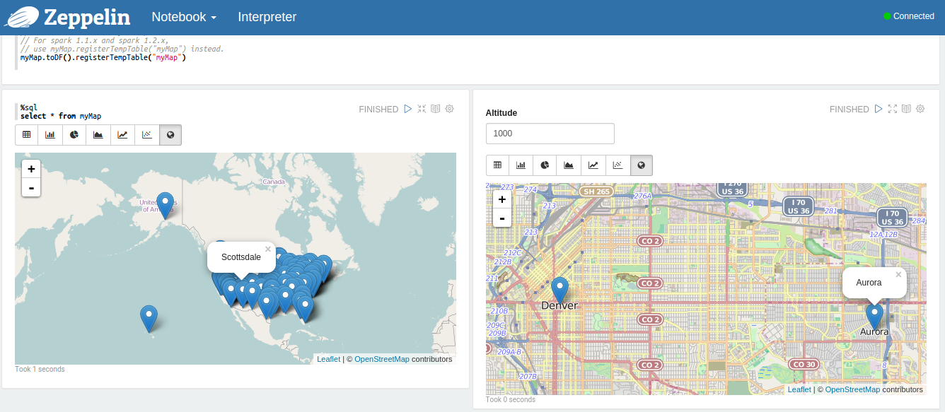
Drawing map with data validation
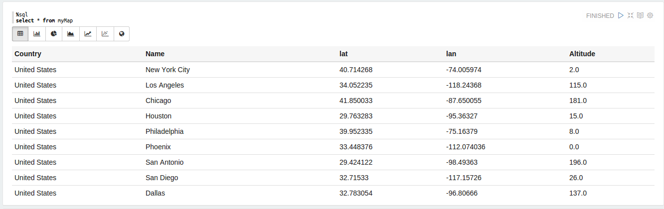
Above is the data set, Data validation will check is Longitude and Latitude is in valid range. Here Map with above data sert